GeoHealth is about understanding the relationships between people, location, time and health. It represents the intersection between two scientific fields, Geography and Health science.
Actually, geomatics (geographic informatics) technology has tremendous potential to address public health issues particularly under the present circumstances of global climate change. In this sense, visualization and spatial analysis, through the use of GIS (Geographic Information Systems), can be very helpful in conveying the findings and results of a study to the decision-maker in a clear and easy-to-understand way.
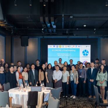
In this context, a transversal training on geomatics for health has been organized at the Institut Pasteur in Cambodia from 27 to 31 May 2019. This training course brought together people from Cambodia, Lao PDR, Myanmar, Philippines and Vietnam to be familiarized with geomatics that include the tools and techniques used in cartography, GIS and mobile mapping and to demonstrate how health geomatics can improve understanding of the important relationship between location and health, and thus assist in Public Health tasks.


The 15 participants work in different Units, Epidemiology, Entomology, Virology, Data management and Municipality Health Authorities; they all need to better understand the spatiotemporal incidence of diseases / density of vectors and related environmental phenomena.
This training has demonstrated that GIS also favor an inter disciplinary approach to the solution of problems, they go beyond conventional spreadsheet and database tables helping us discover and visualize new data patterns and relationships that would have otherwise remained invisible. Data to be integrated into the modeling can cover:
- population data, e.g., census and socioeconomic data;
- environmental and ecological data, e.g., vegetation and land use (monitored through the analysis of satellite images);
- topography and hydrology;
- public infrastructures data, e.g., schools, main drinking water supply;
- transportation networks (access roads) data;
- health infrastructures and epidemiological data, e.g., data on mortality, morbidity, disease distribution, and healthcare facilities;
- meteorological and climate data…
At the end of the training course, participants are at ease with:
- the core functionality of a Geographic Information System (GIS) using QGIS software,
- participatory mapping with OpenStreetMap (OSM) and import of OSM data in QGIS,
- the use of mobile applications for mapping,
- the use of vegetation indices calculated from satellite images (Sentinel-2)
This one-week training course gave the opportunity to country participants to share expectations, difficulties encountered in using data collected in the framework of ECOMORE project components and to clarify how they will contribute in the transversal WP Climate. Participants socialized during festive dinner on Sunday 26th and Thursday 30th and so this smoothed exchanges and discussions in the group.


The success of this training was essentially due to the enthusiasm of the participants and the full commitment of the instructors, Vincent Herbreteau, a Health Geographer at IRD (partner for the Climate component of ECOMORE project) and Arnaud Vandecasteele, PhD in geomatics and co-founder of GeoLab.re, specialized in spatial data acquisition and analysis. They have been assisted by Sokeang Hoeun, Engineer in GIS just recruited to work on the WP Climate.


Add Comment